Product Update: Custom Asset Uploads, Video-to-Splat, and Bollard Buddy for iOS
· 8 min read

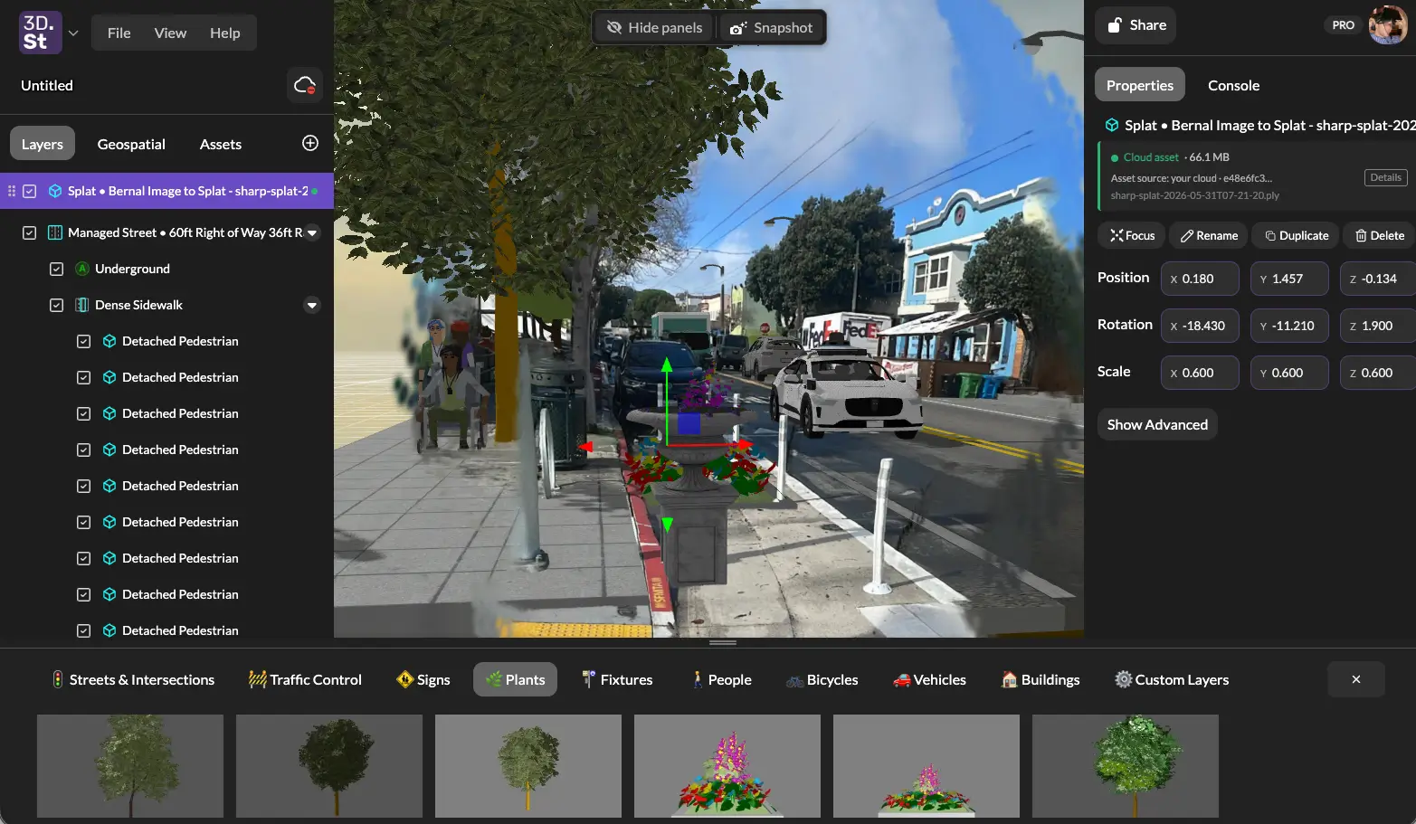
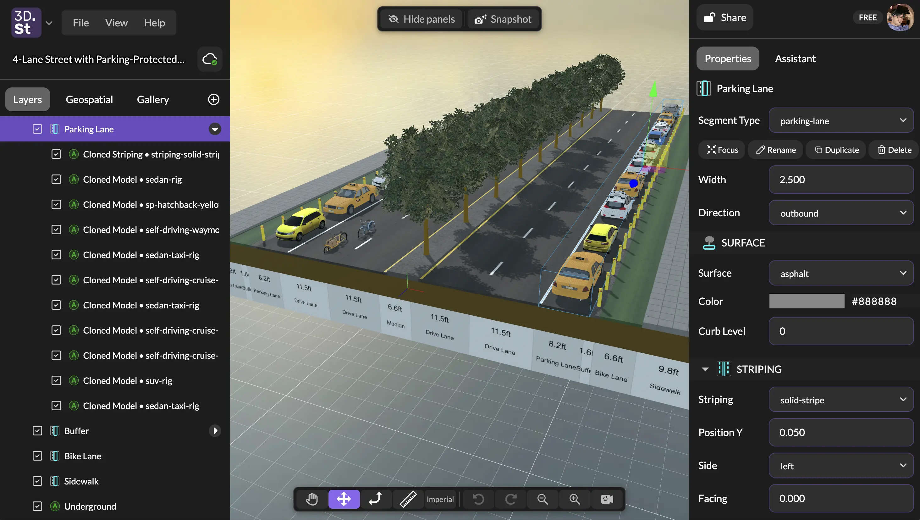
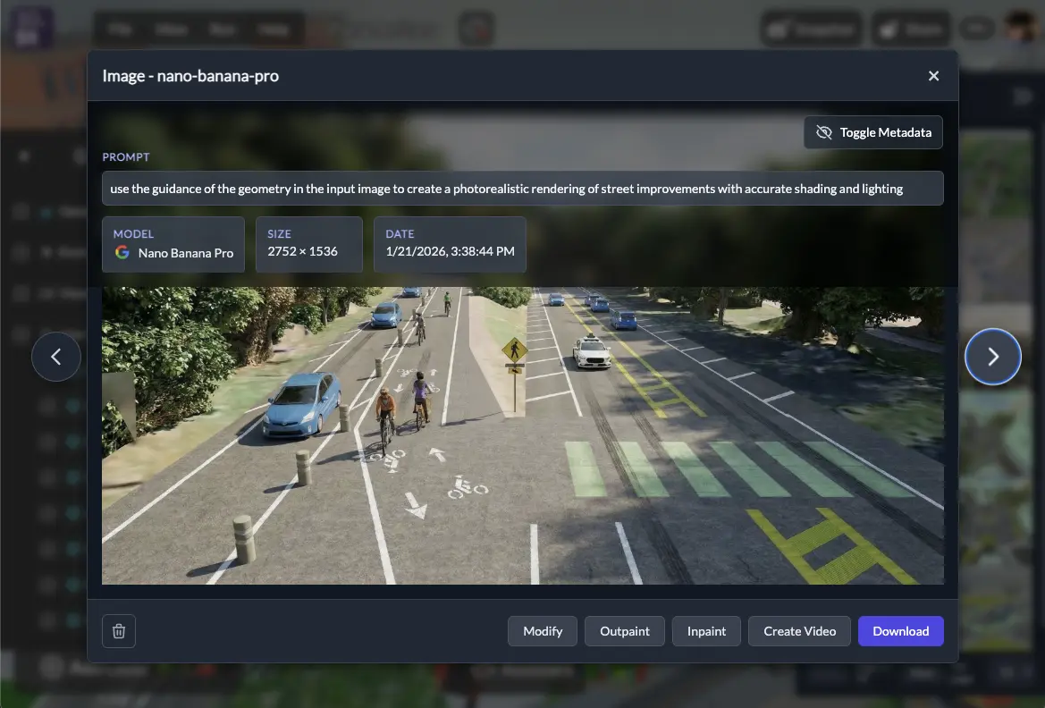
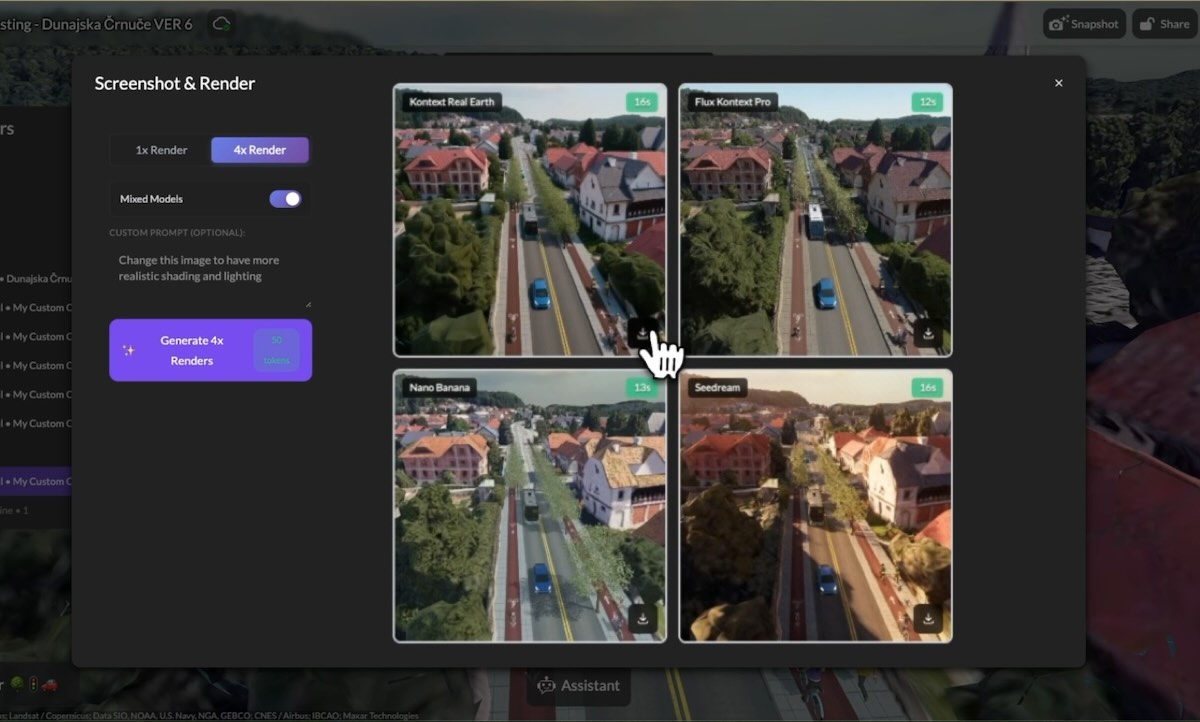
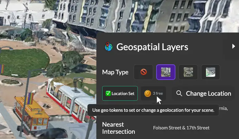
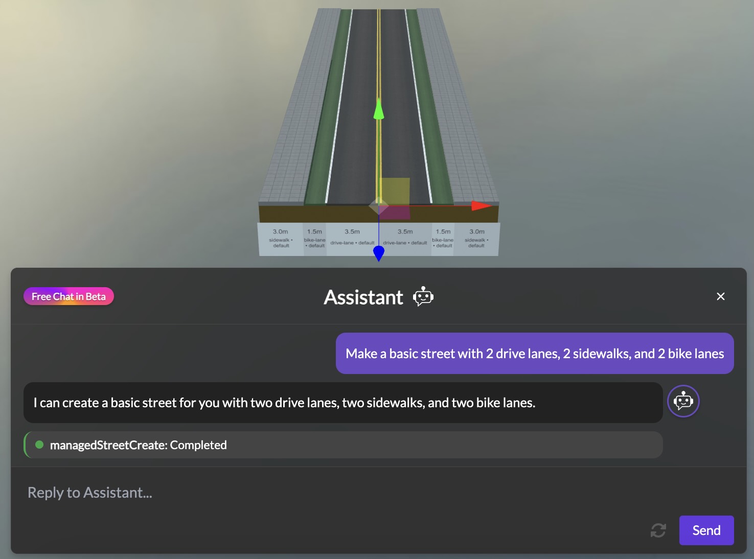
Since a major editor panel interface redesign in late April, we've been busy working on a big batch of features focused on getting your own content into 3DStreet: your own 3D models, your own photos and videos turned into 3D, and scenes you capture in AR on your phone. We've also been putting a lot of work into reliability, especially for Managed Streets (procedural street generation), which we're planning to bring out of beta later this summer. Here's what's new.

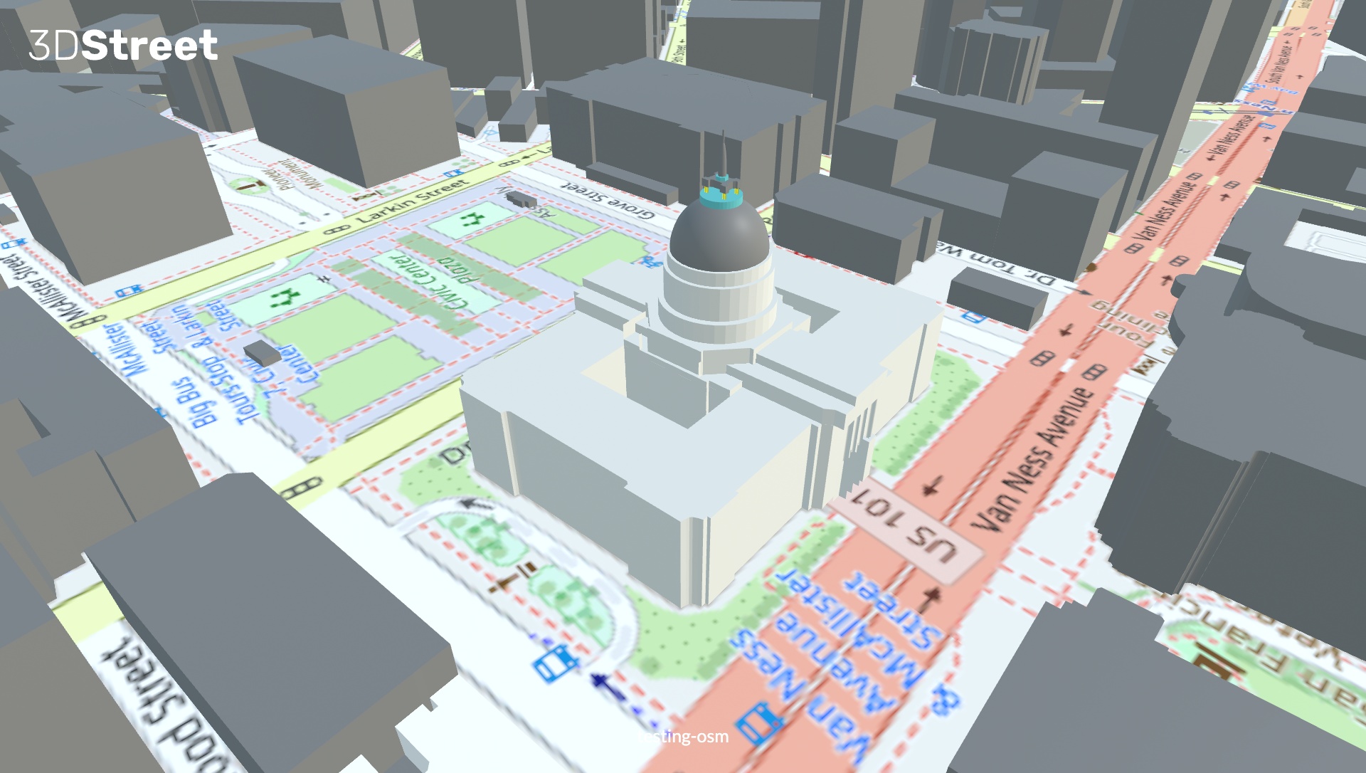 A screenshot of the new 3DStreet OSM integration showing San Francisco City Hall.